
THE GOLDEN FIELDS OF LITTLE VENICE.
January 2019The late Hans Norton was the great local historian of Maida Vale and anywhere else that he took a sudden interest in. He produced a mass of work. And even now, in some of his posthumous papers, are we finding fascinating insights into the history of the area. This story is about the great fields that predated the naming of the area after the Battle Of Maida and the coming of the canals. Where Little Venice and the Grand Union Canal now provide only a hint of rural calm there used to be rolling fields, Great Church Field, Little Church Field and Parson’s Field, and the site of Warwick Avenue Tube station was originally the turning circle of the massive farm carts required. We have, myself, Robert Bruce, and the indefatigable (past) Chairman of the Society, Elizabeth Virgo, walked the route Hans suggested in his paper on the subject. It has taken time. As with many local historians Hans saw things to be clear which often are not nearly as clear to we plodders down the historic byways. So bear with me as I try to bring the past to life. Off on the journey.
Follow me…
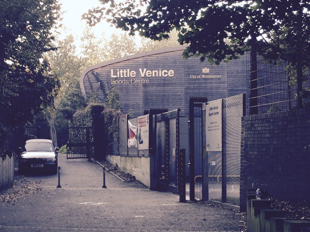
Possibly the best place to start, because it gives you a clear view of the only part of the fields which still exists, is behind the Little Venice Sports Centre. You reach this via Crompton Street, just off Edgware Road on the south side of the canal. Walk into the park beyond. This is the old burial ground reaching down to the church of St Mary’s in the lee of the Westway flyover. But originally it was plain agricultural fields. In the north-west corner of this park there is a raised area which Hans thought was probably the site of the old Manor House, built possibly to replace a very much earlier one, in the early 18th century. Parkland, orchards and the kitchen garden would have stretched to the north, up to where the school is today.
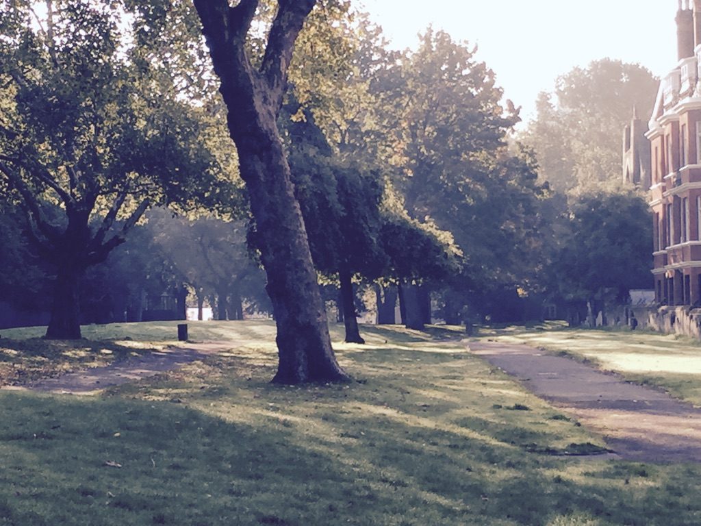
The main area of the park you are in was what would have been Little Church Field. When you reach the point where you are roughly on a line with the entrance to the primary school in Park Place Villas on your right you are on the southern boundary hedgerow of both Little Church Field and what across to the west was Great Church Field. The north-south boundary of the fields ran just to the east of Park Place Villas. Go down to the church, turn right and walk round into St Mary’s Terrace, pausing to doff your hat to the statue of our Emeritus Chairman/President, Christopher Bond and his creation, Paddington Bear.
When you arrive at Fulham Place, the road to John Aird Court, on your left, you have reached the same dividing hedgerow that you had crossed in the park. And to the south of the road and extending westwards would have been Parson’s Field. Walk down Park Place Villas and turn left onto Maida Avenue and stand and look northwards to Warwick Avenue Tube station. This is the site of the great and ancient farming route. The old Harrow Road, which still runs past behind you, was the main trading artery. Farmers needed to get their produce to market. So a road was needed to get to the fields from Harrow Road, and back again. This is why Warwick Avenue is so wide at the bottom where the tube station and the church now are. Farmers needed to be able to turn their carts, once laden and pulled by four horses, around to head back to the Harrow Road.
With this vision of bucolic bliss and hard, hard work in your mind retrace your steps along the canal, all the time reminding yourself that it didn’t exist when the fields were in full production. The north-south boundary between Little Church Field and Great Church Field ran down the west side of what is now the Catholic Apostolic Church.
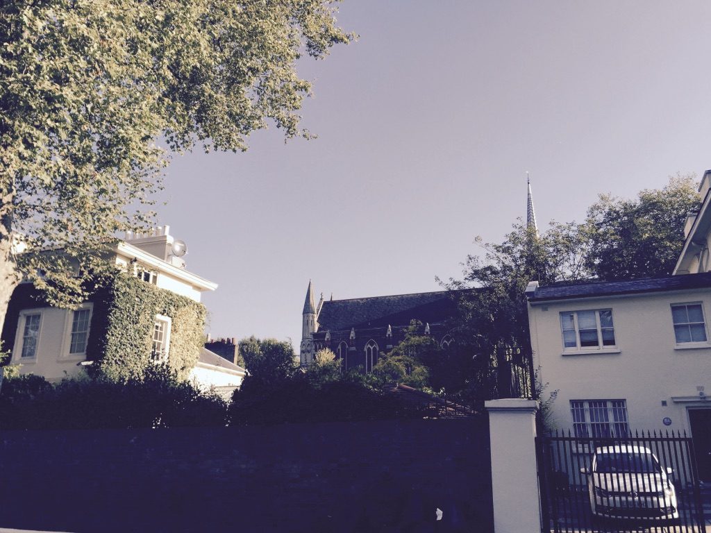
On the other side of the canal the boundary runs between 23 and 22 Blomfield Road. No 23 would have been in Great Church Field and No 22 would have been in Little Church Field. The northern boundary of the field ran westwards along the line of Randolph Mews and, continuing on the other side of Warwick Avenue, along what is now Warwick Place. In fact you could happily stand with a pint of beer outside the Warwick Castle pub and imagine yourself looking over the hedge into the field.
It was the building of the Grand Union Canal, Paddington Basin and the Regent’s Canal that sounded the death knell for the fields. The canal went straight through them. Paddington Basin was established as an industrial trading hub in 1801. The Paddington to Camden Town section of the Regent’s Canal was opened in 1816. In 1824 the Bishop Of London allowed the building of houses in the area. The farmers, raging against change, refused to pay rent on the fields that had effectively been cut in two.
Into Paddington Basin came slates from Llangollen, cement from Rugby, gypsum from Surrey, wood from Scandinavia and Portland stone from London Docks. This is why there is still the old builders’ merchants, Travis Perkins, by the canal. And it is also why a building boom took off in Paddington in the early to mid-nineteenth century.
But it is still possible to stop, stand by a tree, and imagine the rural landscape with its fields and its hedgerows, horses and carts. You just need to know where to look.
We owe an enormous thanks to the late Hans Norton for providing the research from which this article is derived.